Equality Impact Assessment (EqIA):
We have used data and engagement to understand who lives and works within the Railton LTN and the amenities and services that might be impacted both positively and negatively by the scheme.
By assessing the impacts we have seen the benefit of changing the way streets are used and identified ways to reduce any negative consequences of the change
You can read the full EqIA below.
Transport for All:
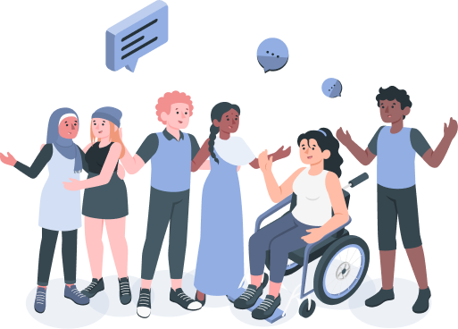
We know everyone experiences changes to the street differently and we have run targeted engagement with specific user groups including a pre-consultation survey. Specifically regarding our Disabled residents, we have commissioned Transport for All to give a more detailed breakdown of how people might be impacted by the scheme, taking a pan-impairment approach.
They are continuing to run engagement during each consultation and the full report will be considered as part of the decision on the LTN.

Since the Stage 1 monitoring report was published we have received 206 emails relating to accessibility, 130 highlighting concerns on increased journey times and 76 emails in relation to other accessibility issues.
Concerns noted:
GPS mapping relating to issues with way finding apps Clearer signage is needed on the ground Incorrect signage The impact and mitigating measures for boundary roads Difficulties delivering to local residents Resident exemption requests. Concerns scheme is money making Fines Potential increase in vehicle journey time/cost for:residents people with limited mobility, health reasons and people with disabilities essential workers and assistance to the area school run Taxis for residents with parking permits for specific CPZs to hospitals/GPs
How we are mitigating against concerns:
Exemption Policy: (You can read the policy note below)
Exemption from relevant traffic filters for Blue badge holders, accessible transport and specified healthcare providers on application to the council Exemption from relevant traffic filters on application for Taxis and fully accessible private hire vehiclesNavigation Systems:
Navigation Systems updated with the latest information via the One Network system. Improve signage and wayfinding for walking and cycling routesActive Travel Planning:
Comprehensive programme of activities across the borough to give people the support, skills, confidence and means to access walking, cycling and public transport as an alternative to private motor vehicle use, including:Cycle Training (bikeability training for all LTN schools) Bikes, Cargo bikes, Adapted cycles try outs Active Travel Festivals (1 per LTN) Public realm improvements:
Improvements to the pavements, kerbs and roads that make it easier to walk or use mobility aids in the LTNs through street audits and engagement Measures outside businesses to encourage footfallImprovements to boundary roads:
Short-term:
Design work on Coldharbour Lane, Dulwich Road, along with a full corridor review of traffic flows, bus priority measures and walking/cycling provision on Coldharbour Lane, Effra Road, Dulwich Road and Tulse Hill. Examples include feasibility of introducing controlled crossings on Effra Road, as well as permitting contraflow cycling on Brixton Water Lane Monitoring flows and congestion, managing roadworks and working closely with TfL on upgrades to improve cycling and walking on roads such as A23 Junction improvements along Coldharbour Lane corridor east of the junction of Atlantic Road and Railton Road, including walking, cycling and bus priority measures at the junctions of Gresham Road and Barrington Road. TfL bus and cycling improvements delivered on Brixton Road and Brixton Hill (A23), including 24/7 bus lanes and low-level cycle signals at junctions to give cyclists a headstart over general traffic. Though not a boundary road for Railton, the A23 is a key local corridor and improvements will help people on bikes to directly access St Matthews Road and to access the Railton LTN via Effra Road, and will improve journey times for local bus users.Medium-term:
Monitor impacts of expanded Ultra Low Emission Zone (ULEZ) Review of road layouts, introduction of measures to improve bus priority, walking and cycling provision. Reinstatement of banned movements at main road junctions where possible Signal timing reviews Supporting measures like greenscreens for schools and community buildings along busier roads Implementation of bus priority, walking and cycling improvements resulting from corridor feasibility and design work along Coldharbour Lane, Dulwich Road, Effra Road (including Brixton Water Lane and Morval Road) and Tulse Hill corridorsLong-term:
Further improvements to bus fleet Electrification / zero emissions vehicles Part of a wider mode shift to walking and cycling Lobbying TfL for continued improvements to signalised junctions and roads under their control e.g. A23 Commitment to carbon-neutral by 2030